MAPS OF THE SELSEY PENINSULA AREA
The following assorted maps and info may assist those newer to the area....

Diagram of the main roads serving the Peninsula area

Diagram of the roads giving access to the Bill-tip. Sea-watching is quite possible from the car-park at the southern end of Hillfield Road, but the traditional sea-watching spot is directly in front of the wall at Bill House, accessed from the southern end of Grafton Road.

General map of the Peninsula area and surrounding locations - with Peninsula boundaries marked.

Plan of the Selsey Peninsula Recording Area (shown in pale)

This map of Pagham Harbour Nature reserve is a little dated, but still very useful in showing key sites around the reserve. Note that the Hide shown at Pagham Spit no longer exists (though the other two hides certainly do!) (Taken from 'Best Birdwatching Sites in Sussex' - by Adrian Thomas)
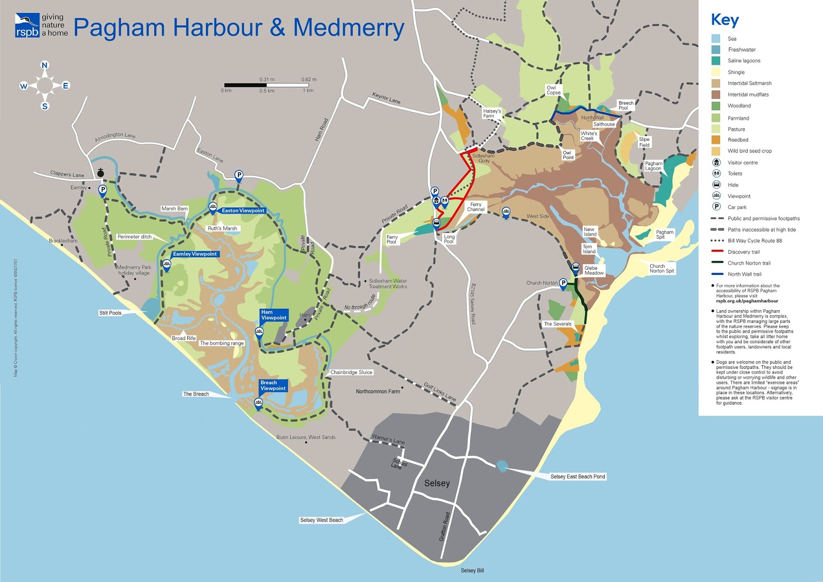
Plan Map of Pagham Harbour and Medmerry, showing the proximity of the sites to each other and Selsey Bill. Note that access to Medmerry is not straightforward and the breach area cannot be crossed, so visits to the east and west sides require separate journeys. A new cycle track is due to be completed from the Visitor centre in the near future, running past the Water Treatment works.
The below publication is available from the Visitor Centre, priced £10 - all of which goes to assist RSPB projects on the reserve(s) - and gives detailed information regarding access, parking and Sat Nav references, essential for planning a visit.

No comments:
Post a Comment